Category Archives: Ideas

The Secrets of Rochester Place

At the end of January, as I was preparing for the Battle of Jarama commemoration I received a message from Sharon:

A friend of my nieces has written her 5th novel, she also writes under the name Nuala Casey, (she is Luke Casey’s daughter) and Nuala Ellwood and this one was under Iris Costello, as it’s a different genre.
The book was The Secrets of Rochester Place . Sharon holds a special place in my heart as she has provided me with a wonderful link to a fascinating chapter in local history, for she is the daughter of Fermin Magdalena; a Basque Refugee who with his brother and two sisters was cared for at Hutton Hall. Julia,  Sharon and Teresa have shared material with me and attended our 2021 Volunteers for Liberty event; they can be seen chatting to me at the event below.
The reason why Sharon was recommending this book in particular is made clear in the acknowledgements :
Nuala has used Fermin’s memories to enrich the character of Teresa, whilst Firmin was settled in the Colony at Hutton Hall, the fictional Teresa is evacuated to London in the wake of the Guernica bombing, eventually finding safety in Rochester Place.  It is a credit to the author that the character of Teresa is such a wonderful representation of a Basque child refugee, Nuala has managed to highlight the myriad of concerns,  challenges and difficulties they faced.

For me Teresa’s story was, of the four intertwined stories, at first the most of interest to me, but that may be because I had invested more into this story thread previously, however the skillful way in which Nuala has woven the four main strands together is the highlight of this wonderful book, quite rapidly I was absorbed into the other three threads. I did not feel, at any point, that the places where the stories touched and linked were contrived or forced, the changes in location or storyline I felt created unsettling changes in pace, which fits the mystery aspect very well. The reader is never comfortable that they have the full picture; there is always a feeling that you are missing out on something, there is a gap in knowledge and this feeling remains right up until the final resolution.

The primary story is that of Corrine, it is set in present day Tooting, where Corrine is an emergency call handler, taking calls from people who need help and talking them through it until the emergency services arrive.  The book starts with one call she gets that is very different  to others, one that stays with her. It’s from a woman called Mary, asking her to save her daughter who is trapped at Rochester Place but when the emergency services get there there’s no sign of Mary, and even more mysteriously Rochester Place is also not there.  Corinne is used to hoaxes but something feels different about this one. The choice of Tooting was quite evocative, as Ta-ra to Tooting  is possibly the most emotional song in The Young’uns The Ballad of Johnny Longstaff.  and you should know by now what that started!

The third story strand is that of Mary, an Irishwoman trying to make her way in the world and in particular carefully make her way in an England which has no linking for Women or the Irish. I feel that it was this character, of the three women, to which Nuala most readily associated herself.

As Sharon had explained Nuala was the daughter of the much loved Journalist and broadcaster Luke Casey, which brings me to why this book resonated so much with me. Luke Casey was born in Ballina, County Mayo, which explains the background given to the character of Mary.

By coincidence I’m currently working on a book about Sam Wild and his mother, Mary Ann McGrail, was born in Castlebar, County Mayo, just ten miles from Ballina, I’m therefore researching this area. Hence as I was reading about the fictional character of Mary from County Mayo and her experiences in England I was writing about a Mary McGrail from County Mayo who travelled to England a decade before her fictional namesake. Obviously this further added to my enjoyment of this fabulous book.

Image from Drake the Bookshop

The coincidences just kept piling up, for Nuala chose to launch The Secrets of Rochester Place at Drake the Bookshop, which as everyone knows is the finest Bookshop in the North of England, and is in Silver Street, Stockton. Sadly I missed this launch event on 15th December 2022. A further coincidence is that it was in Stockton that Luke Casey began his journalistic career; in 1956, having only been in England for two years he started work as a junior reporter on the Northern Echo in their Stockton Office. It was also in this Stockton Office that Luke met Nuala’s mother Mavis, Luke and Mavis had been married sixty three years when Luke died on 31st October 2022; a matter of weeks before the launch of this book in Stockton.

The fourth strand, the story of Rochester Place is hugely evocative of the period, highlighting the affluence of a small number in the inter-war years, which only accentuates the inequality of the times: being aware of and writing on the National Hunger Marches, the reports from Stockton’s Dr M’Gonigle  and the work of George and Phyllis Short I found the contrast with the picture of Rochester Place jarring, which only served to underscore the sense of unease the mystery created.

I try to vary my reading , as I have had a vastly unbalanced bias towards the Spanish Civil War over the past five years. I have read some exceptional books in that time and this book ranks highly. For many reasons this book is very very special, and for this reason it is difficult to portray it’s outstanding quality  – I cannot recommend this book more highly. I think people should read this book – this is the reason I have not talked about the plot lines. It is beautifully written, with a wealth of detail presented in a subtle way, in fact I feel that each storyline could hold up alone, which makes the intertwining and final culmination of the stories so substantial. It will appeal to a very wide audience: those interested in mysteries, those with an interest in the Spanish Civil War and the Basque refugees, those with an interest in Irish History and those with an interest in historical fiction will find this of special interest. However I think this would appeal equally to readers without a special interest in an aspect of the story lines.

When you look to get a copy (note I don’t say ‘if’) please consider getting it from Drake the Bookshop:this can be done by using this link I’m certain you will love this book as much as I do.


An interview with Hild

I loved using the Historyfile series , the best aspect was that they recreated the characters, rather like reenactment, giving life and personality. I am lucky in that I currently work with two reenactment groups: The Newcastle Garrison Living History Group, and The Time Bandits Living History Group.

My latest collaboration with The Newcastle Garrison Living History Group, can be seen in the report on The Great Civil War in The Tees Valley

I have worked with The Time Bandits Living History Group  since 2005, when John Sadler spoke to The Durham Branch of the Historical Association, he was speaking on The Border Reivers, but was dressed as a Great War Highlander, making a lasting impression on me (and a number of our rather elderly members) as he swung the claymore about as he spoke. Both John and Rosie Serdiville became regular speakers to the branch, usually headlining in our annual Christmas buffet.

Time Bandits are a group of local historians who use costume, drama and comedy to educate and entertain.  We cover a wide range of periods from the Stone Age to the 1970’s and work with all age ranges.   We are currently involved in preparing fun online history sessions for families doing home schooling but we’re always happy to come up with a tailor made package for special occasions.  

You can contact them at  timebanditsuk@gmail.com or on Facebook at https://www.facebook.com/TimeBanditsLivingHistory/

My eldest in Year Four he has just begun to study The Anglo-Saxons and The Vikings, living where we do gives us fantastic opportunities for local History studies. He has already visited Jarrow Hall  or Bedes’s World,  I still  find myself using it’s old title.

Ceasing the opportunity, using the Peaham2000 time travelling app  we have managed to arrange for JJ to interview Hild, Abbess of Whitby. Click on the images below to see the recording. sadly Youtube stipulated that it must be in two parts.


Hild of Whitby (614–680) is a Saint, she was the founding Abbess of the monastery at Whitby. The Double Monastery became so renowned that it was chosen as the venue for the Synod of Whitby; where the disputes between Celtic and Roman Christianity in Britain was discussed and some resolved. Hild is seen as an important figure in Anglo-Saxon England, she is recognised mostly  for the wisdom of her advice.

JJ researched Hild, with some guidance, then drew up the questions himself, the recording of the interview was  May 2020/May 680

A special thank you to Rosie Serdiville, from The Time Bandits, for being so supportive.


New Editions

Cuneo, Terence Tenison; The Opening of the Stockton and Darlington Railway, 1825; National Railway Museum; 

Last month I gave a talk at Preston Park Museum to mark the anniversary of the opening of the Stockton and Darlington Railway, meanwhile, on the other side of Stockton my father was also talking, he contributed to the Friends of the Stockton and Darlington Railway afternoon of talks.

On the evening I met the author, Tony Stowers, for his reading of No1 in Middlesbrough Central Library, the photograph opposite shows Tony holding the new limited edition of No.1, and myself holding Lewis and No.1 his book for younger readers. Only last year I had written about this wonderful book, see – https://www.hoddereducation.co.uk/subjects/history/history-subject-community/hodder-history-blog/july-2018/no-1,

For this September’s events Tony had produced this special limited edition of No1 he had purchased the rights to use the Terence Tenison Cuneo painting entitled ‘The opening of the Stockton and Darlington Railway’ which once you read the book you will appreciate how fitting the image is. Cuneo is best know as the leading painter of railways and for securing the prestigious role of official artist for the 1953 Coronation of Elisabeth II.

Whilst talking with Tony he mentioned an aspect he had not considered before, namely the purpose of the Yarm branch line, he’d begun to think about this after reading my fathers biography of Benjamin Flounders – How Durst he do that 

On the day the journey started at Brusselton at eight o’clock in the morning.  The locomotive pulled thirty-four wagons in total, twelve loaded with coal and flour, the other twenty-two carrying upwards of four hundred passengers.  The train covered the eight miles into Darlington in little over an hour.  At Darlington more waggons were added and more passengers boarded, until there were more than six hundred people, included Mr. Meynells’ band, which played at every prestigious event.  The train at times reached fifteen or sixteen miles an hour, but it took almost three hours to reach Stockton, mainly due to a very long delay at Yarm, where the coal wagons were uncoupled. 

How Durst He Do That: the Life of Benjamin Flounders Esq – Jim Fox (page 33)

What was the purpose of ‘a very long delay at Yarm,’ ? It was difficult to say as the Yarm junction mostly overlooked in modern histories of the Stockton and Darlington Railway. I searched a number of my books and then online for any reference to Yarm on 27th September 1825 and came away with little more than passing mentions to the individuals from yarm and the 1925 plaque, I therefore went to the source of the passage, my father.

In the 1875 book, Jubilee Memorial of the Railway System. A History of the Stockton and Darlington Railway and a Record of Its Results, J S Jeans writes:

Stockton was reached in three hours and seven minutes after leaving Darlington, including all stoppages, and one of unusual length at Yarm, where some coal waggons were left, the distance between the two towns being close on twelve miles. All along the line of route, the fields, lanes, and bridges were covered with spectators; and when the procession arrived within a few miles of Stockton, it was joined by a large number of horses, vehicles, and foot-passengers. (page 71)

I’ll be the first to admit that the reference is rather short, but as the book is renowned for being a classic and is highly detailed; it relies heavily upon S&DR documentation, I am inclined to conclude that this account is pretty reliable. What caught my eye however was the rest of this passage, especially the ‘joined by a large number of horses, vehicles, and foot-passengers.’ part for passage, for this brought me back to the cover of No1, and the choice of the Cuneo painting, which shows No1 surrounded by a large number of horses, vehicles, and foot-passengers.

Men such as my ancestor, Benjamin Flounders, were in essence practical businessmen, the cheif objective of the S&DR was to transport coal from the South Durham coalfields, mostly to the port of Stockton, but as it was used locally it was also transported to the larger urban districts; Darlington and Yarm. On top of this the simple spectacle of coal waggons being uncoupled, transported and unloaded would interest a huge number of people, bringing publicity. I’m not saying the stop at Yarm was a publicity stunt, after all the whole day was a publicity stunt, but it is clear that the future operation of the Railway was being demonstrated, the directors were showing people the practical benefits the Railway would bring, drumming up business. What is especially pleasing is the way I have come about this understanding, I have seen how History and historical fiction are created; the use of evidence to verify a statement, the careful selection of information, and then the interpretation and use of that information, which has advanced my understanding.


Embedding local history into the curriculum – It needn’t be a battle

The following is the handout that accompanied my Presentation at the 2018 Schools History Project Conference, I appreciate that many aspects will not make sense unless you were at the presentation, hence please contact me if you have any questions, the aim for posting this is to provide ideas and maybe inspiration.

The aim of this workshop was to demonstrate how local history studies can enrich the History curriculum in all the Key Stages, and more importantly enhance the skills and knowledge of GCSE students, by becoming a synergetic part of the History curriculum. Rather than viewing the local study as an add-on, it took an holistic approach which embeds it in the syllabus. Drawing on Michael Rileys work, it showed how Local History can be subtly incorporated into the curriculum. Spanning all key stages, examples, from battles to memorials to buildings are provided.

“Recently, the incorporation of local history into the curriculum has been given a new impetus, with site analysis now included in GCSE examination courses.” TH168

As teachers of History we are well aware that teaching History through a local study is an effective means of engaging the interest and imagination of students and the wider community.

In my experience, the way local History is taught in many schools is quite different to the teaching of other History topics; for many it is usually crammed in at the end of the course, a pure skills exercise, or a pet project designed to promoted History as a GCSE option. I would argue, if we wish for local history to be taught effectively, it needs to be taught implicitly, as a synergetic part of History teaching; to be embedded within the curriculum.

What is local history?

The term local derives from ‘Locus’, the Latin word for a place, it simply means having to do with a place. Local history in one sense is centred on the places where things happened in the past. Carol Kammen gives us a good definition:

I see local History as the study of past events, or of people or groups, in a given geographical area – a study based on a wide variety of documentary evidence and placed in a comparative context that should be both regional and national. Such study ought to be accomplished by a historian using methods appropriate to the topic under consideration while following general rules of historical inquiry: open-mindedness, honesty, accountability, and accuracy.’ in On Doing Local History (2003)

It can be argued that, all history is local history, because everything that was done in the past was done in some place or other.

Many see local history only as History in your own locality, close to your home, insular and small. Local history, however, covers every conceivable topic which can be studied in a geographical area; smaller than the country as a whole. Including everything from the history of individual people, families, buildings and streets, up to whole regions. By placing these in ‘a comparative context’ we are able to make links to the national and international connections.

The National Curriculum situation is: At KS1 students study:

significant historical events, people and places in their own locality.’At KS2 ‘a local History study’‘a study over time tracing how several aspects of national history are reflected in the locality (this can go beyond 1066)’ and a study of an aspect of history or a site dating from a period beyond 1066 that is significant in the locality.’National curriculum in England: history programmes of study (September 2013).

The definition changes at Secondary school; the KS3 specification is almost identical to KS2, except for losing ‘that is significant in the locality’ in the last bullet point. At GCSE all three boards focus specifically on a place of historical interest in their Historical Environment, or (in the case of OCR) History Around Us section of the examination, they stress that the site must be placed in it’s historical context, which allows for the study of the events and people associated with the place.

It appears that many schools understand local history through the distorted window of KS4, where it is the place, or even the building that is paramount; that local history is little more than a glorified source analysis exercise. I would argue that through the study of local history, we can strengthen the sense of community, we can guide students in their development of civic pride.

Why embed it?

GCSE History is in danger of being an overflowing pick’n’mix, an admirably broad but potentially unsatisfying dash across disconnected periods, where complex events and ideas pass in a blur like a fox in morning mist, half glimpsed from a train window. https://tryingtomakesensejamesvwoodcock.wordpress.com

Taking a Chemistry analogy; students should see their Historical skills as a compound, where they are used in combination, rather than as a mixture in which each element is essentially used separately.John Beckett suggests it isn’t just educators who face challenges:

local history does not have an established network of scholars who can share experience and practice, let alone an effective means of reaching out to the myriads of amateur practitioners across the globe who are working on a locality.’ – Local History in its comparative international context – John Beckett, in The Local Historian – Volume 41, Number 2 – May 2011

Support for local history studies is expanding, as recently as September 2017 we find:

‘The opportunities afforded by local history are far from parochial. The study of a neighbouring town, a local battalion, a village street or even a single building can help pupils to explore questions about the shaping of identity, about the concept of place, and about historical diversity. The value of studying local history is long established and much discussed. It can spark curiosity, strengthen substantive knowledge and make a very distant past more concrete and more relevant. It allows pupils to see the role of smaller stories within broader narratives. A single site or ‘time-thickened’ building can act as a locus for multiple narratives.’ New Novice or Nervous? The Quick guide to the ‘no-quick-fix’ – Local History in TH168

When the SHP re-published their principles a short while ago, we found this:

Generating an interest in, and knowledge of, the historic environment has been a core principle of the Schools History Project since its inception. Engaging with ‘history around us’, and considering what the historic environment can tell us about people’s lives and beliefs in the past, are some of the most stimulating aspects of learning history. The Project believes that there should be more opportunities for children and young people to study ‘history around us’ and it continues to develop innovative approaches to the study of the historic environment. – http://www.schoolshistoryproject.co.uk/about-shp/principles/

So how can we help the vast majority? I feel, if we are going to provide ‘more opportunities for children and young people to study ‘history around us’, then there needs to be more ‘history around us’ in their studies, put simply more students, with more time, studying events, people and places within a limited geographical area.

A sense of Place

People develop a “sense of place” through experience and knowledge of a particular area. A sense of place emerges through knowledge of the history, geography and geology of an area, its flora and fauna,the legends of a place, and a growing sense of the land and its history after living there for a time.http://www.makingsenseofplace.com

A study of a local place encourages students, we can engage them more effectively by helping them to see the value of a place, by developing their historical understanding of the relationships between local, national and international aspects. I have found, in the main, increased engagement; students are much more willing to speak up, which could simply be because they feel thay have greater knowledge, but the resulting effort makes it appear there is more to it than this.

“In an increasingly globalized world, there are often pressures for communities and regions to subordinate themselves to the dominant economic models and to devalue their local cultural identity, traditions and history in preference to a flashily marketed homogeneity.  Place-Based Education: Connecting Classrooms and CommunitiesDavid Sobel (2004)

Not only can a place help students to make sense of the world in which they live, their place in the wider world; helping them develop a sense of identity, it can also provide deep emotional resonance.

Where to embed it?

As local History is recommended in the National curriculum for all Key stages, it seems logical to implement this approach at all Key Stages, to embed local history within Key Stages One through to Five. Some have argued that younger students will not cope with the complexity; that younger students are unable to comprehend the higher order concepts. Arthur Chapman’s Alphonse (see Teaching History 112) has shown that this is not the case, I have successfully used the unfortunate Alphonse with Y5 students, demonstrating to my satisfaction that casual reasoning can be taught from KS2 through to KS5. My reasoning, therefore, is that the concepts needed to study a locality and local history can be developed across the Key Stages, building a continuum of conceptional reasoning.

How to embed it?

When looking at embedding we need to consider it is especially because of it’s geographical restriction, that Local history is best placed to: facilitate the study of individual reactions to events, to practice demographic enquiries and to carry out micro studies.

My approach to embedding local history is based upon Michael Riley’s suggestion:

(LT) Light touch local history: using local sources to start,illustrate, complicate and challenge national narratives.

(H&H) Half and half history: blending local and national history in Key Stage 3 enquiries.

(HAU) History around us: independent enquiry in the historic environment.

Michael Riley – Project Director SHP

Eighteen years ago, Michael began the discussion on arranging and positioning enquiry questions across the whole Key Stage, in his seminal piece Into the Key Stage 3 history garden: (TH99, 2000), he argued for

a restructuring of the whole Key Stage 3 history garden in order to create stronger themes, deeper understanding and greater overall appeal.’

I have taken a KS3 SOW example that I have had no input in producing. Alex Ford has given me permission to use this from his website (http://www.Andallthat .co.uk /ks3-teaching-resources.html)

What you will see in the next version are suggestions for local history elements in the lessons, the bottom row shows a homework suggestion.

Homework

The homeworks are effectively standalone local history enquiries, designed to take the half term to complete, therefore students will practice HAU even if the topic has no or a LT local history element.

An example – Anglo-Saxons

Local sources from the Anglo-Saxon period are abundant, especially north of the Tees; the land of Cuthbert and Bede. A simple and engaging activity is my What can place names tell us about the Anglo-Saxons activity: where students examine the Anglo-Saxon origin of their locality.

Names with ‘ton’ (or a derivative) and a direction in front of it are common – Norton, Sutton, Weston and Eston, for example. Some place names refer to nearby natural features such as Brockton and Brotton – local brooks. Marston and Merston refer to a nearby marsh land while Wotton and Wootton refer to nearby woods.’ (My worksheet)

As you can see the LT can be achieved easily. To create a contrast with post Norman England I try to provide a taste of Anglo-Saxon cultural evidence, with the enquiry ‘What does the evidence tell us about the Anglo-Saxons?’

In the summer of 1982, children playing on a rope-swing beside Mill Lane noticed human bones in the hollow scoured out by their feet. The Police were initially called, who in turn called in the archaeologists. The bones were those of a woman aged between 25 and 35, who had been buried with some of her personal possessions, including a bronze brooch and a necklace of glass and amber beads. These finds were dated to the 6th century. (Tees Archaeology website)

Added to the language evidence this gives context and a comparison for later topics, it also challenges the national narrative that focuses on warriors. The Anglo-Saxon chronicles can be introduced with entries relevant to the locality, and then expanded to the national picture, to give H&H history. The suggested HAU are: the Battle of Billingham in 796 and the Saxon Princess.

A study of the 796 Battle, especially the tactics and weaponry will provide the basis for a comparative enquiry when Stanford Bridge and Hastings are studied later. The Saxon Princess enquiry is because:

The Discovery in 2005 of an Anglo-Saxon cemetery at Street House, near Loftus, came as a surprise as preliminary work suggested that there was only an Iron Age enclosure on the site. Subsequent excavation over three seasons between 2005 and 2007 revealed a 7th-century cemetery with 109 graves, five of high status containing treasure and one containing an Anglo-Saxon bed, the first to be recorded in northern England. (A Royal Anglo-Saxon Cemetery at Street House, Loftus, North-East Yorkshire, 2012)

The Saxon museum homework can be of any scale, students produce a model for an exhibition at a local museum, most museums will have a website if a visit is not possible. The model can be from a simple written description to an actual model, with labels and artefacts; although unless you have a huge storage area, I suggest limiting the size of the model to a shoe box. The advantages of models are that marking of the homework is much reduced, and you have something to display at an open evening. With the focus on the locality, students are researching within geographic and chronological boundaries, which provides, for some students I have found, a security, the familiarity gives them a secure base from which to explore something new.

What to embed?

Archaeology

A good start is the HER; The Historic Environment Records

“HER’s are information services that provide access to comprehensive and dynamic resources relating to the archaeology and historic built environment of a defined geographic area.” . . . “There are over 85 HERs in England which are maintained and managed by local authorities as the essential core of historic environment services.” (https://historicengland.org.uk)

Battlefields

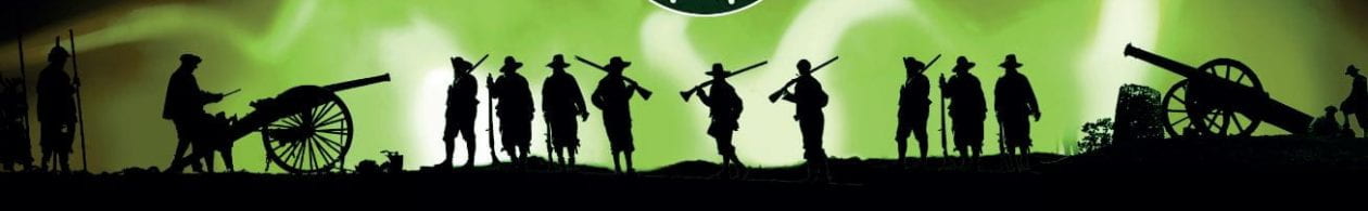
Obviously as a regional officer for the Battlefields Trust I would recommend Battlefields for a local history study – see http://www.battlefieldstrust.com/page154.asp.

Battlefields can provide excellent H&H enquiries, as they provide the link between a localised event and the national picture; there are very few UK battles that do not have national influence. It can be argued that as local history is ‘the study of past events, or of people or groups, in a given geographical area’, every Battlefield study, is a local history study, for they are all confined within a geographical area.

Many students also encounter the Great War through the study of war poetry in English lessons. Students who opt to study History at GCSE may study the Great War, or aspects of it, as part of topics such as ‘Conflict and tension, 1894-1918’ or ‘War and British Society c.790 to c.2010’. At ‘A level’ both the First and Second World Wars features as part of topics such as ‘Britain 1900-1951’, or ‘Germany 1871-1991’. And this is before we look at the GCSE thematic study Warfare Through Time.

Careful study of a battlefield, its topography, structures, history and archaeology can tell us much about the course of a battle, but more importantly it can also tell us about the world in which it was fought and the people who took part. It also has the advantage that the geographical and chronological boundaries are relatively small; literally restricted to little more than a field, on a particular day; most of the time prior to the 18th century.

If I may say so, most battles have an exciting and engaging narrative; there is something to capture the imagination, the one drawback is the lack of structures or buildings.

The advent of digital maps and virtual reality allows HAU studies like ‘What was the most significant cause of the SS Cap Arcona disaster?’ It looks like AQA are having similar ideas, on 7th May 2016, they posted on their website:

We’re delighted to announce the specified historic sites for our GCSE exams in 2018, 2019 and 2020. These are covered in the historic environment element of the British depth studies. . . . for students taking exams in 2020

  • Norman England, c1066 – c1100: The Battle of Hastings, October 1066

  • Medieval England, the reign of Edward I, 1272–1307: The Battle of Stirling Bridge, September 1297

  • Elizabethan England, c1568–1603: The defeat of the Spanish Armada in the English Channel, July/August 1588

  • Restoration England, 1660–1685: The Dutch raid on the Medway, June 1667

http://www.aqa.org.uk/news/historic-environment-sites-announced
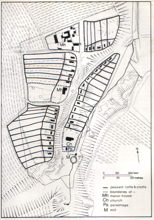
Buildings

What remains of James Pennyman’s North Ormesby?

In 1853 James White Worsley moved into Ormesby Hall.
To inherit James added the surname Pennyman, he almost immediately began to plan a township on his estate land.
Now James White Worsley Pennyman, he rented and sold plots of his land for housing. His son, James Stovin Pennyman, continued to build North Ormesby, until forty years later, in 1913, North Ormesby became a large part of the town of Middlesbrough.

Your task is to explain how and why the township of North Ormesby developed, and using evidence, say what remains.

I found that we could delve deeply, considering small aspects which then led to further enquiries; for example, the Cottage Hospital in this model village was one of the first in the country. A homework task for GCSE Medicine Through Time students not only compared this to Medieval hospitals, but also set up the sequence of lessons on the formation of the NHS. More detail can be found at http://thenandnow.edublogs.org/

A ‘Then and Now’ image is also much simpler now than ten years ago when digital cameras were so expensive. Local Buildings, or even the lack of them, can be used for LT in most topics, from the Anglo-Saxon Church to the Cold War Bunker – see A List of all known “Cold War” Nuclear Bunkers and Subterranean Complexes in the UK.

At 1.42 on Saturday, 25 May, the first German bombs to fall on an industrial town came down near North Ormesby. Twelve more fell as the aircraft flew on a corridor over South Bank and Grangetown. The last device exploded near the Dorman Long steelworks, injuring eight men. http://news.bbc.co.uk/local/tees/hi/people_and_places/ history/ newsid_8701000/ 8701200.stm

An advantage of buildings and structures is that they can be used to develop heritage trails, you can literally have points in the trail set in stone.

Structures are ideal for local history, which maybe why the GCSE specifications for the local study appear to be heavily skewed towards structures. They are also ideal for LT, the TV programme ‘A house through time’, has demonstrated how a depth study of just a single building can lead to an exploration of regional, National and International History, something which I have replicated with students; the Deanston Distillary building has a fascinating history as well as a personal connection. As Michael Riley demonstrated at the 2017 summer conference in his Picturing the past session, reconstructions can be as valuable as site visits.

Displays

My son’s Y2 homework was designed for display, it was a culmination of his local history project.

I would consider homework to be outside the remit of standard classroom activities, displays fulfil a similar role. The simple task of requiring students to produce ‘pen portraits’ of significant individuals from the locality was expanded to a display in one school.

This year has seen the completion of the £8 Million refurbishment and renovation of Middlesbrough Town Hall. Leading the outreach programme enabled me to design materials that studied the building in depth, but also gave us the possibility of opening out the enquiry to the general public. A hardhat tour, allowing students to study the interior of the building during the renovation, was followed by a tour of the exterior. Nine Junior Schools and three Secondary Schools took part. The timeline on the hoardings, placing the building within it’s local historical context, was very popular, receiving positive comments from the local media.

Events

Clearly most events will come under the local history criteria, as they will happen within a geographical area, and many will have national and International significance. However even the most mundane events can enhance an enquiry; The Billingham Manorial rolls from the medieval period are a good example.

Middlesbrough being the first British industrial town to be bombed in the Second World War, is a LT with a powerful effect, rebelling against the London-centric focus of ‘The Blitz’ has, I have found, incentivised students to study the topic. The raids on Thornaby Aerodrome and ICI Billingham a fortnight later, in early June 1940, highlight the bombing campaign which preceded ‘The Blitz’ on London.

As a contrast, the embedding of local history can be used to work in the opposite direction; rather than take a local event and use it to enrich a National or International topic, one can zoom down from an international event to draw out it’s significance to the locality.

Very few people have heard of The Battle of Stockton, but this event on 10th September 1933 can be used to show the influence of a number of National and International events on the town of Stockton-on-Tees. A century earlier, the events of the 27th September 1825 is recognised as being of International significance, and is rightly celebrated. Rather than look at it from the perspective of a local event; I suggest we could take an International aspect and zoom back to 1825. The enquiry question ‘Why on earth would Vietnam choose to put Locomotion on one of their stamps?’ has rarely failed to capture the imagination of students. 

A benefit of using local events is that the enquiry can draw from the local community, allowing students to engage with people from outside the school; thereby engaging the interest and imagination of students and the wider community.

Memorials

How should we remember . . .” enquires are popular. One of the advantages of memorials are that they mean different things to different people; like events they are open to interpretation.

The German word for monument is Denkmal, which translated means ‘thought object.’ If we are clever we can use these monuments, including those of the Confederacy, to be instructive, by interpreting them within their context. (Take the Journey: Teaching American History Through Place-based Learning, James A Percoco, 2016)

We can use these ‘thought objects’ to help students to think about context, feeding context into local history, and memorials specifically, thereby enriching and developing enquiries.

One example of a topical and controversial memorialisation is the campaign to mark ‘Peterloo’. The Peterloo Memorial Campaign (http://www.peterloomassacre.org) are working hard on the bicentenary events, and can be used to examine the various ways we now memorialise events and people. The beauty of memorials is that they enable the development of most of the historical skills; Significance, interpretation and diversity. I was struck by the differences between the design of the smaller district memorials, which was reinforced when I did some research on a Stockton VC winner; there are two Middlesbrough VC winners to compare. Although I have not developed upon the idea, it strikes me as great opportunity to examine the similar and different ways in which we memorialise both events and individuals.

Poetry and Song

An interest in the potential of song as a source of evidence in the history classroom has burgeoned recently. Mastin, Butler, Sweerts and Grice all make the point that songs possess a power to engage and draw students into the study of history. Few would disagree that songs make excellent initial stimulus material and most of us, at one time or another, have employed song in this way. For me, however, the real significance of that selection of previous Teaching History articles is their suggestion that song can deliver much more than this. Songs can, they propose, be incorporated into the processes of historical enquiry and play a role in developing students’ historical thinking. Songs can in fact be used to develop students’ conceptual understanding of history. (Introduction to Down the foggy ruins of time: Bob Dylan and the concept of evidence. Chris Edwards TH 140, 2010) https://foggyruins.wordpress.com/

In 2006 I hosted a workshop showing how I used song and poetry to enrich enquiries. Following Chris’ lead I have now begun to use them in a much more structured way to enrich local history enquiries. I have moved beyond just using a song to provide a narrative of an event or place, to using them to challenge the preconceived idea that some sources have more authority than others, this has allowed me to develop how students conceive of sources as evidence.

A good example of this is John Barbour’s The Brus; his most renowned work, an historical verse poem about Robert the Bruce. The length of the narrative poem does create a challenge, but this is well worth overcoming to highlight the historical, and more particularly the patriotic elements that make clear the purpose of the poem. I feel the preconception that poems and songs lack the authority of more ‘academic’ sources, makes them less daunting for students to access.

The cholera’s coming is short enough for students to explore every aspect, but can tell us a lot about what people understood about the causes and remedies at the time of the 1832 Cholera outbreak. It is also valuable in developing students understanding of how to use evidence, for it challenges the concept of sources of information, by addressing the constructed hierarchy of reliability.

songs like Dylan’s are historical representations conveying meanings about the past.Down the foggy ruins of time: Bob Dylan and the concept of evidence. Chris Edwards TH 140, 2010)

The term ‘Folk Music’ derives from Folklore; the traditional beliefs, customs, and stories of a community. Folk music, by definition therefore, includes traditional music and songs, making many contemporary to the topics we study.

After exploring stories relating to homophobia, the refuge crisis and the foundation of M&S in their 2017 album Strangers, the 2018 touring project The Ballad Of Johnny Longstaff sees TheYoung’uns turn their attention to a very different story. Combining songs with archival photographs and oral history recordings from the Imperial War Museum, multi-media show The Ballad Of Johnny Longstaff explores the life of a lad who found himself witnessing, and partaking in, a remarkable run of historic and life-changing events. https://www.whatsonlive.co.uk/birmingham/event/the-glee-club/the-younguns/251111/107491/799#interviews

The Young’uns (http://www.theyounguns.co.uk) first came to my notice when I became involved in The Battle of Stockton memorial campaign (http://www.Battleofstockton.co.uk) as they have a song of this title on their ‘When our Grandfathers said No’ album. If we take this one song as an example, it can be used in a number of ways to develop historical understanding: it provides a narrative of an historical event, it illustrates, complicates and challenges national narratives.

I would suggest this song can also be used in an enquiry which is focused on any of the historical concepts: continuity and change, cause and consequence, diverse experiences, or significance, and with the addition of the local history aspect it can help students to gain an historical perspective. This song can be used to develop students’ conceptual understanding of history, whilst additionally, developing the skills they need for a local history enquiry.

Deeply embed local history

Few subjects can be as emotive as The Holocaust, and there can be a danger of over emphasising the emotional aspect; students can become overwhelmed by the scale and depth. A sense of place can help to contain, and to some extent help to control the emotional aspect; to enable students to handle the context and content more easily. However it can also be used to demonstrate, in an accessible way, the impact of the events on individuals. The Task Force for International Cooperation on Holocaust Education, Remembrance and Research encouraged and advised us to use witness testimony and to:

Individualise the history by translating statistics into personal stories.

Hand Book for teachers Guidelines for Teaching about the Holocaust

We can talk to students about events in Vilna, or in the Vilna Ghetto, but without a sense of what this place is, students lose out on the nuances and complexity, and will fall back on stereotypes and generalisation. Vilna can be used to demonstrate the complexity and uniqueness of the Holocaust in a way Auschwitz-Birkenau cannot, students can relate their own experiences much more readily, they can study a street, homes, kitchens and bedrooms that will have some similarity to their own. Vilna is a place in which, prior to 1941, live was ‘ordinary’ the people lived their lives much as we do today, whereas Auschwitz-Birkenau is unique, it is extraordinary, there is no place on Earth like it.

A carefully chosen place, can be used to support students in their reasoning, at the simplest level, it is allowing them to use prior knowledge that would take hours to acquire through study; they don’t need to research a home, for example, they will have prior understanding, and will be able to relate to the emotions attached to a home. Local history provides deeper resonance, enabling the development of deeper historical understanding.

What is local history?

local history is the study of past events, people or groups, within a given geographical area.

A sense of Place

A sense of Place can help students to make sense of the world in which they live, also their place in the wider world, helping them develop a sense of identity, it can provide deep emotional resonance.

Why embed it?

The study of a town, a local battalion, a village street or even a single building can help students explore questions about the shaping of identity, about the concept of place, and about historical diversity; local history can develop their historical skills.

Where to embed it?

As local History is recommended in the National curriculum for all Key stages, it seems logical to implement this approach at all Key Stages, to embed local history within Key Stages One through to Five.

How to embed it?

(LT) Light touch local history: using local sources to start, illustrate, complicate and challenge national narratives.

(H&H) Half and half history: blending local and national history.

(HAU) History around us: independent enquiry in the historic environment.

Homework

What to embed?

  • Archaeology

  • Battlefields

  • Buildings

  • Displays

  • Events

  • Memorials

  • Poetry and Song

Deeply embed local history

A sense of place can help to contain, and to some extent help to control the emotional aspect; to enable students to handle the context and content more easily. However it can also be used to demonstrate, in an accessible way, the impact of the events on individuals. Local history provides deeper resonance, enabling the development of deeper historical understanding.

The presentation can be found here:http://prezi.com/o8nqgvtofxj1/?utm_campaign=share&utm_medium=copy&rc=ex0share

it is suggested that one refers to the above notes to aid explanation of some aspects, if you have questions or require clarification, then please contact me at foxy.foxburg@ntlworld.com

Why research is worthwhile

For the Battle of Stockton campaign handout, I relied upon four original sources, all newspaper accounts; two from 1933 and two from the opening of the 21st Century, although the latter two are based upon the 1933 accounts. Without verification I chose to leave out some key information points; a significant one was the number of Fascists at the rally. Wikipedia seems pretty certain on the strength of both sides, but these numbers don’t match the referenced sources at the bottom of their page or the 1933 newspaper reports. Where had Wikipedia got the numbers from? Neither Chris Lloyd’s Northen Echo report, (http://www.thenorthernecho.co.uk/news/9309751.The_Battle_of_Stockton__1933/) nor The Telegraph obituary (https://www.telegraph.co.uk/news/obituaries/1470744/John-Warburton.html) mention numbers, and the 1933 Newspaper reports state 150 Fascists and ‘several thousand Communists’.

By chance, after the narrative was printed, I found that a Police report still exists for Sunday 10th September, giving an alternative contemporary version of events. The Police report states 80 Fascists on the High Street. I think it is reasonable to assume a measure of discrepancy; we can speculate why the BUF may wish to overestimated their support, and the Police may wish to play down the incident. A further freshly found source gave me ‘100 blackshirts’, this figure comes from The Young’uns 2011 song The Battle of Stockton (http://www.theyounguns.co.uk/). I now felt I had the alternative accounts I craved. On 5th March 2018 The Young’uns most recent album, Strangers, was awarded best album at the prestigious BBC Radio 2 Folk awards. Congratulations boys.

Apart from the omnipotent internet, students tend to rank the Police highly in terms of reliability, they have greater credibility. Chris Edwards’ 2010 article Down the foggy ruins of time: Bob Dylan and the concept of evidence ((Teaching History 140) https://www.history.org.uk/publications/resource/3622/teaching-history-140-creative-history) has shown how collections of songs can be used successfully to help students develop more powerful ways of thinking about our knowledge of the past, and single works can be used to develop evidential thinking. From experience I have found students rank these works, designed to entertain, less highly than official documentation: a Police report for example; I therefore felt I had a great selection of contrasting sources to test reliability.

The sources give different figures for the number of Fascists at Stockton: the Police say 80, the Young’uns say 100, the 1933 newspaper reports say 150 and Wikipedia say 200-300 – double all the others. The next stage is to set up the context and provenance for each source. I considered creating an enquiry studying the four sources, exploring such questions as: why was it produced? What motives or intentions can be seen? What thoughts and beliefs does it suggest? What views or opinions are shown? Before measuring reliability. I am well aware that students have a preconceived hierarchy of reliability for sources. Students tend to link this to trust, asking which source do I trust the most? By this simple measure students assume they are dealing with reliability, but trust is too unequivocal, it is too blunt an instrument, limiting the outcome, you either trust the author or you don’t. The mnemonic DAMMIT can help students get so far but without context and knowledge students assumptions usually prevent them from evaluating the source effectively. Like Chris Edwards, I wanted to challenge their assumptions to develop their assessment skills.

Students can be asked to consider how the figures are arrived at; what is the intention of the author? What motives lay behind its production? What similar experience could the author have had? Why are they different? These can help students produce suggestions as to how the figures were arrived at, but more importantly think about why the authors are suggesting these numbers. This is one of the fundamental aspects of evidence; we wish our students to consider the sources carefully, we want them to be critical of evidence without being disparaging, to embrace the complexity of sources and their production. We also want them to consider the author of the source. Does it matter how many blackshirts marched up to the top of the High Street, and then scuttled back down again? Not really, but how the number is arrived at can be important, for it helps us to understand a little of how and why evidence is produced.

This brings me to a rare advantage, I am lucky enough to be in touch with two of the authors of the sources. I can ask Sean, from The Young’uns, how he arrived at the number 100. I suspect it is more than just lyrical, although this alone can be a valid reason. The number 100 has a mystical dimension; most of the world’s currencies are divided into 100 subunits. We measure distance, age and time by centuries. In Anglo-Saxon England a ‘hundred’ was the division of a shire, the list is vast. In this case the number one hundred is almost perfect, and convenient; eighty four just doesn’t scan as well. In this case, however, this number also appears to be the best estimate, so what evidence is it based upon? How did he arrive at this number? As an alternative I can ask Chris Lloyd why he, like me, chose not to state the figure, or why does he not trust Wikipedia? If they need any enticement I can promise them some Battle of Stockton Ale, I’m sure this at least can be relied upon.

Apart from the enjoyment I have derived from the research, I have also found a different perspective when considering reliability, pushing down to the macro level, focusing on a small aspect of the evidence has shown me that we don’t need a detailed source in order to assess it’s reliability; context and provenance can play a big part. More importantly I have found a way to express the concept that reliability is not exact, that reliability is complex and variable; there is more to it than whether a source is trustworthy. I will now plan to assist students to assess the level of credibility of sources as their skills develop, to accept that the reliability of sources are limited by the fact that they are produced, on the main, by human beings.


If only everything was as reliable as a volkswagen

I feel lucky in the fact that I have the opportunity to engage in projects which have open ended outcomes, for this gives me the flexibility to examine issues from an aspect of interest. I have never felt confident teaching reliability; this may be because it is linked to many similar concepts, such as validity and accuracy, therefore I am trying to improve my own understanding.

When working on a narrative of an historical event, I want the information to be as accurate as possible; therefore I test the source materials, If I am to use it, I must trust it, I must believe in it’s reliability. Maybe because I don’t feel confident, I have always found reliability a complex issue to teach, it is a term I, like many others, have used in the classroom many times; I ask students to assess the reliability of a source in assessments.

One aid to understanding reliability is demonstrated by one of my old starter activities entitled As reliable as a Volkswagen’, which used an old Volkswagen advert. More recently I came across a Tweet from Dan Snow (@thehistoryguy)‘You know, there’s this subject you can take in school which teaches how to evaluate information and the reliability of sources. . . . . . It’s called history.’ , and then we get the annual Horace Greasley story – (https://rarehistoricalphotos.com/himmler-prisoner-staring-defiance-1941/) reappeared on social media, accompanied by the multiple comments confirming the ‘truth’ of the story. The confirmation is usually based the assertion that Greasley’s widow was certain it was him in the photograph face to face with Himmler, and faith trumps analysis. I have also spent some time re-reading Chris Edwards’ 2010 article Down the foggy ruins of time: Bob Dylan and the concept of evidence ((Teaching History 140) https://www.history.org.uk/publications/resource/3622/teaching-history-140-creative-history) reviewing his practical approach to misconceptions and reliability. I had been speaking to a colleague about a series of lessons on Civil Rights, and how I got students to compare and contrast two accounts; one the song The Lonesome Death of Hattie Carroll, and one a contemporary newspaper report. As you can see I seem to be seeing reliability all over the place, I am lucky enough to be doing some ‘proper History’ research; actually going into the archives and studying Police records and local newspapers, as opposed to my usual research – flicking through a textbook and using the best sources I find.

I’m doing this research for The Battle of Stockton campaign (http://www.battleofstockton.co.uk). The campaign is only a few months old, and in this time we have been remarkably successful’ on 9th September 2018, the Mayor of Stockton-on-Tees herself will be unveiling a plaque, in the High Street, commemorating this little-known event. Along with the unveiling, there will be a number of other events, we have speakers: our local MP, Marlene Sidaway of the IBMT (http://www.international-brigades.org.uk/) and the Historian David Rosenburg. The huge publicity from The Battle of Stockton Ale launch in January generated momentum for the campaign, so much so that we are already planning the 2019 commemoration.

We found that the events of the 10th September 1933 are not well known locally, and even less so nationally, there are very few written accounts, and of these, most are very similar, if not identical. The earliest account is from the North East Daily Gazette newspaper’s report of Monday 11th September, with the dramatic tabloid style ‘Razor blades thrown in Stockton clash’ banner headline top and centre of their front page. This appears to be the basis for all subsequent accounts, thus as this is the primary account, its reliability is well worth investigating.

I’m confident that the majority of students, when asked to analyse a text, such as the Gazette account, and the, near identical, Hartlepool Northern Daily Mail report; also of 11th September 1933, will spot bias. These valuable reports are useful and can also be judged on reliability, especially through an enquiry of the eyewitness’s accounts. Take the quotes in the newspaper reports, for example, all the quotes come from BUF members, telling us something about the membership of this new grouping; their priorities and outlook. There is an issue in the newspaper reports with the blurring of the boundary between direct quotes and the writers report of events, giving the impression that the reporter witnessed the ‘lawful parade’ first hand. It is quite clear, however, which side the reporter favours:

A coloured man brandishing a heavy pole struck down a young Fascist, who, at the time, was facing the other way.”

and

The actual fighting did not begin until a member of the crowd poked his two forefingers into the eyes of a blackshirt.” 

both Hartlepool Northern Daily Mail, 11th September 1933

For me these accounts are simply wonderful; the details seems to be taken straight out of a Laurel and Hardy film, in fact it makes one wonder if the comic violence shown in Sons of the Desert; released just four months later, was inspired by such reports as these. I can imagine a sneaky Communist stealing all the Blackshirts’ shoes and then laying tin tacks in their path, or someone handing out exploding cigars.

The major drawback with these reports is that they are so one-sided, the individuals are drawn as crude caricatures, underlain with a simplistic good versus evil foundation – however this time the good guys are dressed in black. The challenge for us in the History classroom, is that all subsequent accounts of the events are based upon these reports, the narrow focus of the narrative, with its glorification of the violence, detracts from an understanding of the sequence of events. In an enquiry, when we ask students to consider the source of the information, consider the evidence that is presented, think about how the evidence fits into an explanation, and evaluate the information with respect to prior knowledge, we can usually give them plenty of sources with which to compare. Here there appears to be just the one biased account, with no alternative narrative to measure against, judging and assessing reliability with this in mind seems a tricky task.

After a colleague suggested “seems to me if it’s on wiki that will be a reliable source.” I decided to see what this could produce, I find that Wikipedia is customarily an entertaining source to use, therefore I was initially surprised to find an entry for The Battle of Stockton, (https://en.wikipedia.org/wiki/Battle_of_Stockton) with a handful of references, I was disappointed to find these references are either based on the 2011 Chris Lloyd article for the Northern Echo (http://www.thenorthernecho.co.uk/news/9309751.The_Battle_of_Stockton__1933/) and the associated radio broadcast, or The Telegraph’s 2004 obituary for John Warburton (https://www.telegraph.co.uk/news/obituaries/1470744/John-Warburton.html). Disappointing not because of the quality of the reports, but rather because the references are so limited, and in the case of The Telegraph too brief. I was left, in reality, with comparing a 1933 newspaper report to a 2011 newspaper report. As this is not ideal for measuring reliability or utility, it led me to abandon my plans for the time being.

Fear not, this was only temporary, I’ll write about how this difficulty was overcome in a later post.


The Great Escape

The real GEA number of Years ago the branch had Guy Walters talking to us, and ever since I have been reading his work.

I present here a one off lesson idea, based on his work, looking at interpretations of ‘the Great Escape’, using the film to pick apart the myths.

this is the presentation, giving the basic instructions as well as a clip showing the first few minutes of the film  http://prezi.com/gbrls6oh1paq/?utm_campaign=share&utm_medium=copy&rc=ex0share

a great folly is a word document, a heavily edited copy of a the book review in the Guardian newspaper, this can be used as a stand alone information sheet, to support a discussion of the accuracy of the film’s interpretation, or as intended to be used with the  Myths sheet, to help students contrast myth from reality.

The The Great Escape Film shows sheet, was intended to get students to think about the film’s interpretation, to help them consider key aspects which are either key aspects of the escape, or are myths to be challenged, you may wish to change or add to the sheet.

There are numerous sources available on the great escape, I feel that a few other sources may be useful, but I don’t want to be too prescriptive

Stalag Luft III was built in the German province of Lower Silesia near the town of Sagan, which is now Żagań in Poland. It is only 100 miles South East of Berlin, thus it has many similarities to the concentration camps, in that they were not built in the outer reaches of the Reich, away from prying eyes. It has been suggested that the site was selected because it would be difficult to escape by tunnelling; because of the sandy soil, which characterises most of Poland, and was a factor in Einzatsgruppen planning also. As two escapes were via tunnels this suggestion needs examination.

I plan to look at the 1943 escape by Lieutenant Michael Codner, Flight Lieutenant Eric Williams and Flight Lieutenant Oliver Philpot, from Stalag Luft III as described in the 1949 Eric Williams novel The Wooden Horse, as this was a great escape

This site http://therealgreatescape.com/ looks useful

Teaching and learning with digital resources

Why do we laugh at a joke?
One of the remarkable things about laughter is that it occurs unconsciously. You don’t decide to do it. While we can consciously inhibit it, we don’t consciously produce laughter. That’s why it’s very hard to laugh on command or to fake laughter.
Local History is a bit like this, students acquire local Historical knowledge unconsciously, but we find that use of this knowledge is inhibited by its unconscious acquisition; it is not ‘learned’, thus, it seems, students regard it to be of much lesser value than knowledge acquired more formally. On the other hand, I have found many students to be insular, most would find it difficult to place people and events in their correct Historical context, as they did not have sufficient knowledge of the world beyond their local area. With a keen interest myself in Local History, I found this enabled me to build strong relationships  with students, as I was taking an interest in them and the places they were familiar with.
This chapter aims, therefore, to overcome students usual inhibitions, and help them use their local knowledge to drive forward their Historical understanding, to expand their knowledge and horizons.
I have found that people in general, and students in particular, are interested in anything that has a local angle, we like to see the familiar linked to extraordinary people and events, This chapter will present a journey, where the ordinary becomes the extraordinary, allowing teachers to inspire and sustain students interest.
A further incentive for looking at local History is the access to resources. Not only are the resources close geographically, but it is highly unlikely that the resources you will look at will have been studied previously. For example much has been written about the ‘Christmas Truce’ in 1914, but little has been written about the bombardment of the North East coastal towns a week earlier. Local History provides the opportunity to study unique and, mostly, fresh resources, something that has in the past motivated my students, it will inspire your students knowing that they are trailblazers, knowing that they are the experts, that they know more about the topic than anyone else.Combined, these factors have a huge impact on the motivation of students. As a  reassurance I feel that I must point out that the ideas and activities presented here were developed using limited ICT resources, with access to ICT facilities restricted I was only able to use ICT sparingly, thus I feel that the ideas presented here can be replicated whatever ICT facilities are available to you.

Middlesbrough 1832
From http://www.thisismiddlesbrough.com

An Overview – Significant Features
For over a decade, whilst explaining change and continuity I had used the images of 1750, 1830 & 1890 from Expansion trade and industry( J Cresswell and P Laurence, 1993, Oxford History Study Units  ISBN 0 19 917197 1), my students have used, variously, MSword, MSpowerpoint & MSpaint to annotate each image, then used the product to complete an assessment on change and continuity. As I had been doing this for over 10 years, for me it had become stale. Further reflection also found that it did not relate well to the student’s prior knowledge, for example no student could identify the significance of the extra windows on some cottages, as they could not identify, and had no knowledge of weavers cottages outside the activity I presented to them.The activity did not really allow for Historical skill progression.
What I really wanted was an actual view of the student’s home town, Stockton, or Middlesbrough, in 1750, 1830 & 1890, this would allow me to expand the assessment to build a scheme examining, in detail, how an actual town had developed. The use of ICT made this more possible, as it enabled me to produce resources specific to the aim of the series of lessons. Using ICT for this activity had two advantages over taking the activity from a Textbook, firstly the activity can use resources specific to our local area, rather than generic resources, and secondly the cost, Textbooks are costly, especially if one uses only one activity from the book, I would not need a class set of Textbooks for one assessment.
I managed to get hold of three images, and was surprised to find that, as well as looking at change and continuity, students also began to question and examine the provenance of the images, and  to discuss why particular views were chosen at specific times. The activity evolved from the original description of change and continuity towards assessing interpretations of change.
With the assistance of the Geography department, who were looking at urban renewal, we began tasking students to taking photographs of Middlesbrough, and found that we were taking pictures similar to those taken 100 years earlier. This led to the two departments combining their schemes, students would study Middlesbrough from 1830 to the 1960s in History, then look at Middlesbrough’s development and future renewal in Geography. We found this worked well, we were flexible, because we were developing new schemes, this enabled us to change and review various methods and activities, depending upon the changing circumstances. For example when we could no longer take students out of the school to take photographs, we set the activity as a homework, as a result this lead to a greater variety of  images we could use. Many other challenges actually improved the outcome, for example; I had visited the local archives to see the old photographs available, I wanted the students to choose the photographs to be used in the enquiry, from the ones the archives could make available, It would mean taking away hard copies of the photographs and scanning them in school, before we could use them. When the visit was cancelled, students e-mailed the archives and received digital images in reply, giving us higher quality images to work with, and speeding up the process.
On further reflection, a drawback of using photographs exclusively was that we could not examine every aspect of Middlesbrough’s development, this limited in the changes we could access, restricting the student’s achievement in the assessment. I then looked at using maps also, as these could give another context to the development of the town. It could also mean that we could focus on a very specific area of the town, looking in greater detail and measuring the changes more accurately.

Using ICT students annotated and marked various maps, we scanned the maps, then using Macromedia Fireworks I then produced them in different colours, for example I used blue for 1782 and yellow for 1831, this allowed the blue to be seen through the yellow. I also found at that the transparency tool in the image manipulation software, worked very well in showing changes, I also found that in adding more maps of different dates, the students could also examine the speed of change. Differentiating I fed students additional statistical data, as additional research resources, using ICT I  could focus these on individual students without losing the focus of the enquiry, or the interest of the students.
I wanted to improve the quality of the students learning experience, thus, influenced by Michael Riley’s article in Teaching History  (TH99 http://www.history.org.uk/shop/product_993_37.html) I decided to follow this depth study with an overview, I now aimed to get students to challenge Historians’ views of Middlesbrough’s most significant dates, to ask students to develop another Historical concept, Significance. For this development study I needed to expand our enquiry a little, from a focus on Middlesbrough to an enquiry looking at the whole of Teesside.(see additional note 1)

Full circle
It was at this stage that I realised I had come full circle with the original activity, now I was using the original  activity with Y7s, I was using Prezi to present the three images, as I prefer Prezi to MSPowerpoint especially as one can easily zoom into and out of images. The Y8s were using  photographs and maps for their change & continuity activity, and  were also looking at significance, which continued into Y9, this one activity had provided continuity throughout the KS3 scheme of work.. Following M. Riley’s work on a thematic approach (http://www.schoolshistoryproject.org.uk/ResourceBase/ThematicApproachtoKS3.htm) I enhanced this continuity by developing more rigorous, and linked, enquiry questions for each enquiry.

IWM Fellowship
I was lucky enough to be accepted onto the Imperial War Museum Fellowship course in Holocaust education. As part of this course, we visited many places, carrying out activities, but it was in Krakow that one activity inspired me to develop my Local History scheme further. Like all high quality activities, the depth of understanding is enhanced by the simplicity of the task. Paul Salmon, the course leader, separated us into groups of four, each group were given identical sets of photographs of the Krakow Ghetto, our task was to find the view shown, and then take a modern photograph of the view, with the old view in shot. The task made us look closely at Krakow’s buildings, and also orientate ourselves within the area of the Ghetto.
At the time I thought this activity would be ideal for local History, as it would enable students to study in detail their local area. It was only one return, and on reflection that I realised the depth of understanding the activity could create. One image of the activity in particular demonstrated the power of this activity. It showed the deportation of Jews from Krakow in 1943, as Marshall Mateer, who took the photograph, says, “what has happened in addition to the matching is that the rest of the student group, on the left-hand pavement, have become, in the new photograph, observers of the scene of 70 years ago; they are caught by the camera as time-traveling bystanders of the events of 1943.” ( http://www.shapesoftime.net/)   Our group, to the left of the image, became unwitting witnesses and bystanders to the deportation, creating a powerful emotional stimulus to classroom discussion. I realised that we were doing more that just taking photographs, I realised that, if my students carried out this activity in their local area, this would develop their Historical understanding. Speaking with Marshall I was struck by his comment “While some photography is a matter of snapping – quick response style, a lot of photography is about reflection, patience and absorption over time.” These were the Historical skills I wished my students to develop, knowing if they could do this with photographs they could, eventually do this with other evidence and record.

It was shortly after this that I had stroke of luck, I was asked to produce some educational Materials for the National Trust site Ormesby Hall ( http://www.nationaltrust.org.uk/ormesby-hall/) . Here I was given the freedom to produce the dynamic active learning activities that were so frowned upon in my school. We produced two activities; the first was to plan and produce a ‘Heritage Railway Trail’ for Ormesby Hall and present it to a panel, using the notoriety of the TV programme ‘Dragon’s Den’. Without Wi-Fi at Ormesby Hall, students felt limited by their lack of access to the Internet, but we found that this made the students much more creative. We also found that by making the students ‘request’ resources from the Internet (the NT office had Internet access) there was a better structure to their planning, which fitted well with the ethos of the activity, in fact we later developed the activity by restricting resources, students were given a ‘Research and development budget’ and all items they used had a cost, how they used their allocated budget became one of the criteria upon which the ‘Dragon’s’ judged them. Each group of students were provided with a laptop, with MSOffice software, they has access to digital cameras and could request internet searches and images which were printed out for the group. We found that the limiting  of ICT resources became a real talking point, teachers who brought students to Ormesby Hall for the activity commented upon how focussed and engaged the students were, they were not as distracted as they usually were when dealing with ICT.
The second activity was a ‘Mystery Activity’, using Peter Fisher’s model (http://www.amazon.co.uk/Thinking-Through-History-Peter-Fisher/dp/1899857443) we gave the students a main enquiry question, we asked students to explain ‘Why did the Pennyman family build the township of North Ormesby’  (see see my CPD presentation  http://prezi.com/n-spy08h7cyz/mr-pennymans-north-ormesby/) after an initial sort activity to set the context and challenge misconceptions, students planned and researched before presenting their conclusions. We found that during both activities students requested maps of Ormesby Hall and North Ormesby for annotation, thus we added Macromedia Fireworks, as the image manipulation software to the laptops, this led to some interesting use of images, which inspired further activities. We came across a weakness with MSPowerpoint during the presentations, the students found it difficult to zoom in and out of images. At school, with internet access I could use Prezi to overcome this problem, but at this time producing ‘Prezis’ offline had not become available. I was pleased to find that this enquiry led towards a number of different enquiry threads, I therefore developed further activities based upon the story of North Ormesby.
The use of maps on the laptops enabled students to demonstrate the similarities between North Ormesby’s village centre and nearby Middlesbrough Town centre; for example both were built with four roads leading from a central square, the students discovered for themselves that the towns were ‘planned’.

from the 1895 map
http://thenandnow.edublogs.org/about/third-enquiry-a-depth-study-what-remains-of-james-pennyman%E2%80%99s-north-ormesby/

From this we looked at North Ormesby in more detail, using the same enquiry question we looked at the buildings. I had recently visited Saltaire (http://www.saltairevillage.info/thus I asked students to compare North Ormesby with Saltaire, to get across the concept of a ‘model Village’, again we annotated maps. The 1895 map of North Ormesby shows the two schools, a church and a hospital, all built by the Pennyman’s for the community, students commented that they now saw the philanthropic side of James Pennyman, which added complexity to the students answer to the main enquiry question.
Having an electronic copy of the 1895 map, I could not resist comparing the 1895 map to the current map of North Ormesby, I overlaid the 1895 map, as a Google Earth template, over the satellite image. I found the controls very easy to use, but found that it took an age to get an absolutely perfect fit, as one had to use multiple reference points, and it was this that gave me the idea for another student activity. Put simply I asked the students to produce the North Ormesby Overlay, asking them to identify, on the satellite image, the sites of the schools, church and hospital. In the plenary discussion after this activity I found that the students now had a surprisingly detailed knowledge of North Ormesby, they found the labelling of the streets in Google Earth very useful for lining up the map correctly, but subconsciously they had noticed the street names, pointing out to me street names relating to the Pennyman Family, that they had retained from a previous activity (Pennyman St. and James St. being the most obvious). I discovered that whilst the students were lining up the maps, they had to examine the map and the satellite image in detail, zooming right in, this meant that they examined the site in a great deal of detail, and gained knowledge of North Ormesby, which I could then use and place in context. This is where the activity was starting to gather a momentum all of its own, for this gave me many more ideas for further activities; to explain the street names of North Ormesby would be just one, unfortunately the Headmaster’s policy of no out of school activities, and the difficulty in gaining access to ICT resources, restricted the development of these ideas.The experience did, non the less, led me to experiment with Google Earth and overlays, the most successful was setting a Year 7 homework, asking students to use a map of Wharram Percy (http://www.abandonedcommunities.co.uk/WPPlan1.JPG) as a Google Earth overlay, this would instigate an enquiry into Medieval Village life.

It was at this watershed point that I had some luck. The Head of Humanities at another Middlesbrough school, invited me to participate in their ‘Y7 Humanities Day’, with the aim of highlighting local History. As I had left my previous school I jumped at the chance, I only had ten days to plan an activity, thus I suggested that; one group visit Ormesby Hall to participate in the activities I had helped design, and now they provided, and a second group I took on a walking tour of North Ormesby, using the resources I had developed earlier. The students on the walking tour were given copies of the 1895 map, the overlay, information about the Pennymans, and school digital cameras. The students were tasked with producing a presentation entitled ‘What remains of Mr Pennyman’s North Ormesby’, essentially looking at change and continuity. We looked at the History of North Ormesby whilst visiting the sites of the two schools, the church and the cottage Hospital, finding that one school and the church remained, we examined the changes, we visited various streets, taking photographs of buildings and the street names. I had laminated copies of old photographs of North Ormesby, thus I tasked the students with an adapted version of Paul’s Krakow Photo activity http://prezi.com/n-spy08h7cyz/mr-pennymans-north-ormesby), the alteration I made was to cut the photographs, to allow more of the current view to be seen. I also had the complete image for students to refer to, and found that these were helpful. The walking tour demonstrated the advantage of digital cameras, for students could check the photograph they had taken instantly, and if it was not perfect they could take another, this was particularly evident during the photo activity, as students debated how best to get the perfect shot, with reference to the buildings they were photographing. They were able to compare the image shown by the camera with the original, we found that the activity made the students really look at their surroundings, they examined the context of the buildings as well as the buildings themselves.

On return to the school, the students had numerous photographs, but almost every group, of four from the class of thirty, focused upon the ‘then & now’ photographs they had taken using the cut up old photographs I had provided, they said they were the most useful. I wanted the students to do more than show views of North Ormesby, thus we asked them to annotate the images using Adobe Photoshop. Inspired by Sergey Larenkov (http://sergey-larenkov.livejournal.com/tag/leningrad) I also asked the students to develop the ‘then & now’ photographs, I gave them additional old photographs, and asked them to merge them with the photographs they had taken, either using the transparency tool, or the mask tool. I found that the students became very enthusiastic, also that they had developed a sophisticated understanding of Historical change. For example, although the Cottage Hospital was the first in the country(http://www.hospitalartstudio.co.uk/gallery/first_cottage_hospital/index.html) the site was now a Health Village, students showed, using Prezi,  that this could demonstrate both change, and continuity, they did not see 1895 as a starting point and 2009 as the end point, they could describe the speed of change. The Hospital was founded in 1860 and operated until its demolition in 1982, Nothing of the original building has survived except for some stain glass windows, which were taken to James Cook University Hospital in Middlesbrough, but in August 2011 were given a permanent home at the North Ormesby Health Village, just metres from the site of the original building. Students placed the local cottage Hospital in context, using it to show the change in emphasis in Health provision, from small local ‘homes’ to the modern multi-site hospitals. Prezi was used as it allowed the students to zoom in on a specific part of an image, to highlight a point. For more detail see http://thenandnow.edublogs.org/
We were pleased with the students presentations, as most were far more than simply showing old photographs and then current photographs, many showed the significance of the buildings, and the innovative grid layout for the village. We gave the students a choice in presentation software, many chose to use Prezi as they had not used it before, and the novelty appealed. Some used Powerpoint, some used Moviemaker or Photostory. We found that the ‘videos’ were the least successful presentations, as they did not really answer the question, the audience and the presenters were passive, whereas those using Powerpoint and Prezi could present an argument, and field questions.
On reflection the ICT resources used to present the end product needs to be considered, the presentation should be appropriate to the learning outcomes. Discussing the activity with students a few weeks later, I found that some wished to continue the activity, I suggested that they could produce a ‘walking tour’, using Google street view but we found this impractical, as the image on the screen cannot be annotated. I did work with one student who annotated screen grabs of North Ormesby in Google street view, but I felt the end product was not as dynamic as the documentary another pair had done voluntarily in their free time.
We were aware that the activity had grasped the imagination of the students, firing their enthusiasm, we were surprised to find that the Year 7 students wished to continue, they wanted to share their knowledge of North Ormesby more widely, the students were eventually given a page on the School’s History department website, to blog their new findings, this proved useful, as it showed collaboration between the different groups; something not possible on the day. What was positive was that the students continued to demonstrate knowledge they acquired subsequently, for example a couple of students wanted to enquire into why the War Memorial appeared to be on consecrated ground, something we had noticed but not discussed on the day.
The culmination came when a school contacted me to say that the students had written to the elected Mayor of Middlesbrough; this was because, on our walking tour, we had found that the Northern part of North Ormesby was being re-developed, Pennyman Street no longer existed, a new housing estate was being built, changing the layout of the roads. The students proposed that one of the new roads be named Pennyman Street, ‘to recognise the contribution of the Pennyman family’, I was sent six carefully argued letters from students, I added a letter of my own, explaining the context; that the students had studied the heritage of North Ormesby. This was delivered to Middlesbrough Town Hall. It was a bit of luck that the school decided to do this through me, as we received a rude and objectionable reply. I let the teacher know, but we decided not tell the students there had been a reply. The students’ letters were, however, later used by their teachers as evidence of a high level of achievement in Humanities, we felt that they had demonstrated an understanding of significance, as well as change and continuity. The initial photo activity had led to a range of outcomes, inspiring both students and staff to produce more and more.

I had been using Peter Britton’s  Interactive Map of World History for a number of Years, and had used his The Rise and Fall of Nazi Germany( http://www.amazon.co.uk/TimeMaps-Rise-Fall-Nazi-Germany/dp/0954797108) with my GCSE students. It was about this time that I had a lucky encounter, the school had just purchased IWBs for every classroom, but had provided no training or budget for software. Speaking to Peter at the 2008 SHP conference he told me about the Dynamic History Maps Timemaps were just about to produce, they were still in the initial stages, but the concept seemed ideal for my needs. After seeing a sample I told Peter that  this was the best software I had seen for years, I subsequently wrote a review which can be found on their website http://www.timemaps.com/reviews . What was so impressive was that “The maps clearly show change and continuity, as well as chronological development, within specific time periods.” Of all the Interactive history map modules they have produced so far the Black Death one ( http://shop.timemaps.com/products/the-black-death) has proved to be the most useful, the organic nature of the spread is most striking, I have used it with KS3 and KS4 students. These dynamic interactive maps got me thinking about the presentation of Historical  information. With the Timemaps interactive maps, students can see changes; they are given enough information to begin to explain some of the major changes, as well as setting a strong chronological framework for my units of work. Since 2009 I have come across a range of products that aim to replicate some element of the Timemaps resources, some have been useful in parts, for example http://www.conflicthistory.com/#/period/1940-1946 which I found useful in introducing a topic, but I have not come across resources equal to Timemaps, as Peter and Jonny have focused their resources, to developing Historical understanding in the classroom, and continue to produce dynamic maps which fit into the curriculum. What I found particularly useful is the depth study approach, the dynamic maps do not try to cover too much, thus they can be used to give an overview, they can also be used to frame an investigation, giving sufficient information for a short enquiry, or providing the basis for a more detailed enquiry. Students of all ages could navigate freely, and I gradually used them less and less for introducing topics, and began to integrate them into my schemes and activities. These maps made me think about how I was presenting information, the dynamic maps are a useful student tool, I found them most useful when students used them independently, students used the maps to structure their enquiry, as the main resource.This became my next aim, to produce resources that students could use, rather than consume, moving from presentations for students, towards students producing multi-media representations for themselves.The products are flexible enough to use with individuals or whole classes, without being prescriptive. The Dynamic maps led me to re-evaluate my planning, to raise my expectations for the end product from a scheme.

In 2009 I was asked to produce educational resources for an exhibition to be held in Newcastle’s Discovery Museum, this expanded to become the Siege and Storm exhibition, which was held in Newcastle and Sunderland, it looked at the English Civil Wars period in the North East. The focus of the exhibition would be the siege of Newcastle in 1644. http://www.twmuseums.org.uk/discovery/thingstoseeanddo/exhibition/2011/02/12/siege-and-storm-civil-war-in-newcastle/
After the North Ormesby project, I had continued to use Googlemaps, thus I found it relatively easy to transpose a map of Newcastle’s city walls in 1644, as a template, over the Googlemap of the current city. I set this as an initial task for students, finding, as I did with North Ormesby, that this simple task brought out a lot of contextual information, for example, we saw that the one bridge across the Tyne in 1644, destroyed by the defenders, was located on the exact spot of the iconic Tyne Bridge. This allowed us to link to Geography, to discuss location and settlement, and to discuss change and continuity. Siege of Newcastle Image Overlay
I trailed the educational resources with KS3 and KS4 students, usually in ICT lessons, as the museum felt that electronic resources would be more accessible than a ‘Teachers Pack’ filled with worksheets, thus I looked at software which would be freely available or relatively easy to acquire. The students began to take on a more active role in resource production, moving from consumers of to producers of, activity ideas
After a brief demonstration students found it relatively easy to place a template in Googlemaps, but found it time consuming to get it placed exactly, but this led students to examine the area carefully, especially the Gallowgate area, as it has a large part of the remaining city walls. I was lucky in that there are number of descriptions, but very few visual representations, thus I felt this provided me with a wonderful opportunity to create reconstructions using ICT.
I used  Googlesketchup as it was installed on the school computers, students were also familiar with this software as they had used it in ICT lessons, they only needed a quick refresher. Students attempted to create a 3D reconstruction of parts of the wall, I had intended to separate the city walls into sections, and allocate sections to different students, to result in a complete reconstruction of the city walls of 1644, but lack of evidence made this almost impossible, therefore we focused on the East, and Close gates as these were attacked, as well as the Sand gate as the wall ran along the river bank here.
Googlesketchup  has a lot of pre-set, pre-designed components, but I wanted students examine the walls in detail, to get their interpretations as accurate as possible, thus they studied the photographs of the remaining walls that I provided, we had to use the paint tool to ‘paint the walls’ with large brick texture, but other than this we found we could produce a reasonable interpretation. I used this activity to explore interpretations, showing how different interpretations arose from using the same evidence. The fact that these were ‘computer generated’ seemed to aid this, as students were more willing to accept that there were differences between the sketches. It was relatively easy to guide the discussion towards Historical Interpretations. This was especially useful for the KS4 students examining a site for their controlled assessment, as part of the assessment was to look at the English Heritage interpretation of the site.
With their own interpretation of the walls, students began to take ownership of the study, I wanted to take this further. A graphic novel had been produced for the Siege and Storm Exhibition, using this as the template I tasked students with producing their own documentary, most students had experienced this task with me previously. Some students had their own video cameras, and consequently had access to some sophisticated editing software, others used MS Moviemaker to produce the documentaries. We used the images from the graphic novel heavily, as well as some of the Google maps and  Googlesketchup products. 
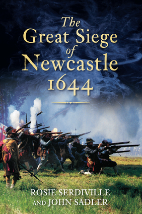
The basis of the documentaries was ‘The Great Siege of Newcastle’ by Rosie Serdiville and John Sadler, (http://www.amazon.co.uk/Great-Seige-Newcastle-1644/dp/0752459899) as I was lucky enough to be given the draft by John Sadler prior to publication. The writing of the scripts helped students to see how selective History can be, a few commented on how much they had to leave out, and worried that this provided a distorted view of the siege. It was at this point that I felt that we had developed a high level of Historical understanding, Students were creating Historical interpretations, where they had carefully considered the evidence and were mindful of how the use of this evidence could be distorted. I had tasked the students with producing a documentary about the Siege of Newcastle, but we found that this was too wide. To narrow it down students focused on a particular group’s view of the siege, for example, a Scottish infantryman, or a Newcastle coal merchant. I was concerned that this approach would lead students away from Historical documentaries towards fiction writing, based on the event, but I found that as long as students avoided speculation they kept the Historical integrity of the documentary. A further advantage of this approach was that students wanted to learn more about their characters, outside of the siege, giving greater depth to the characters. The most pleasing aspect was that the documentaries which focused on the more ordinary characters were more interesting than those on the bigger players, such as Marley and Leven. As a separate activity, some students used Comic Life  to produce their own graphic novels, but the lack of relevant and accurate images meant that the results did not really add much to the project.

As mentioned, students felt the short documentaries lacked both depth and breath, after discussion, to enable more detailed description it was agreed that the only solution would be to produce a narrative. I made students aware of the time and effort John and Rosie had put into producing this book, therefore in the short term they required something which would provide more immediate results. As most students had a Facebook ( and at this time sometimes Myspace)  accounts I found it easy to introduce students to blogging, I used Edublogs http://edublogs.org/ as this site is specifically set up for use with students. Students wrote about their research, and presented some of their work. What was noticeable was the self-editing by students, they did not put everything up, they carefully selected the material to be put up on the site. It was at this point that I realised that it was the students weredriving the project forwards, they were coming up with new ways to present the stories of the siege. One of the plugins for Edublogs was Twitter. One student planned to set up a multiple character Twitter account, with different characters ‘tweeting’ about their experiences before, during and after the siege, this was quite complex, requiring difficult chronological planning, alas, as the SLT were unwilling to unblock Twitter this idea was not pursued, although I do think the idea has potential. ( see http://www.schoolhistory.co.uk/forum/index.php?showtopic=14406&hl=twitter) One interesting aspect of the siege was the correspondence between the Earl of Leven, besieging  the city, and John Marley, the Mayor defending it. We used the animated movie making site Xtrnormal to demonstrate this, with the two characters reading out their correspondence, this site was useful in getting students to analyse the correspondence, it may have lacked historical accuracy, but did present the information in a fun and interesting way.

It was at this point that I felt that he project had lost focus, we appeared to be using new applications to present information about the siege, but had lost the connection to the exhibition. In the initial planning of the exhibition a virtual tour was listed as a desirable element of the exhibition, but costs preventing one being produced, I decided to task my students with producing a close approximation. As students were familiar with Google maps the first task was to add photographs to the Google maps we had produced, we used the ‘My Places – Create Maps’  aspect of Google maps and set them to Unlisted, but without narrative explaining the image we felt this was unsatisfactory. At this stage the applications and technology could not match our ambitions, the freely available software was not powerful enough to create the types of product we were coming close to producing, thus we consolidated what we had achieved by producing a virtual Siege and Storm exhibition. Using HTML software as the base students produced a multi-media exhibition, using aspect from the exhibition itself and their own products they produced an electronic exhibition. With very little guidance students replicated most of the elements we included in the exhibition itself, with educational resources and activities on their sites, as well as links to the accompanying materials, such as the graphic novel. As well as giving a nice focus for the activities we had been carrying out, the virtual exhibition allowed the students to examine Museum exhibitions, to look at some of the limitations placed upon exhibitions, to see them as historical interpretations. The final exhibitions were informally matched against the ICT NC levels, with surprising results, we were confident that most students were proficient at using evidence and communicating about the past, I added an assessment of the exhibition, to be conducted during a tour of the actual exhibition, to enable students to clearly demonstrate a high level of Historical interpretation, but as we could not conduct a school visit, this was confined to assessing the virtual exhibitions, I found, in fact, that I almost had too much evidence. As I was teaching ICT on supply at this point, I decided not to formally assess the students ‘work’ as they clearly enjoyed the project immensely, finding it engaging and enriching; they spoke of seeing themselves differently, as team-members, as contributing to the exhibition as equals. This helped me, and the museum, examine the use of educational materials, we moved away from prescriptive worksheets, towards suggested activities, looking along the lines of more active learning, and giving more open ended activities. Making the students part of the production process benefited the students, I felt that the added responsibility and freedom I had given them, accelerated their learning. An added bonus was that I collaborated with the students, I had people to share ideas with, and discuss new strategies or activities with. It would be this model that I would try to use in some future enquiries, to partner the students in their enquiry, rather than lead them. More detailed planning is needed for this model to be transferred to the classroom, it does require a lot of effort from students, thus they need to be motivated. I feel that my students were motivated by success in simple activities which grew more and more complex, as well as being given freedom to explore avenues of enquiry beyond the initial task, and to find lines of enquiry that did not lead to success, without penalty. For example, we looked at using Foursquare, to give visitors ‘badges’ for visiting sites associated with the siege, but as this had just been launched we felt it would have limited appeal, it would be just a gimmick. This was also true of monster milktruck which was fun, we enjoyed travelling around a 3D landscape of modern Newcastle, but became distracted by the modern 3D buildings. It was rewarding to see students rejecting ICT applications that could not provide relevant or worthwhile activities, demonstrating their understanding of the task as well as the importance of producing a high quality product for the museum service.

The Siege and Storm exhibition opened in both Newcastle and Sunderland in February 2011, one of the most successful additional resources was a map produced by the museum, giving a walking tour of existing sites relating to the siege. We had wanted to do an electronic version, but at the time of planning, in 2009, Googlestreetview had limited coverage, thus when Googlestreetview began to extend it coverage in 2010 I looked at how it could be used. It is useful to visit places which would be beyond the budget of a school trip, but without context I find Googlestreetview  little more than a provider of still images of buildings of interest. During the exhibition Historypin came to my notice, this site effectively copies the ‘Then and Now’ photo activity, using scanned photographs and Googlestreetview, the ability to provide provenace for the images is a real bonus, it has potential to allow student to conduct the then and now Photo activity virtually, avoiding the difficulties imposed upon school visits, but, I feel, without the collection of old photographs and the physical link to the site, it will be much less rewarding and motivational. A Colleague of mine, Maurace Savage, set up Video History todayhttp://www.videohistorytoday.com/) initially he aimed to just show short videos of Historical sites, but realised that they had educational value, and, after discussion we agreed that his videos could be used in students documentaries, or could be used as an alternative ‘virtual tour’. Although not ideal I feel that tools and resources are becoming available that will enable students to produce multi-media virtual tours of Historical sites that they have not physically visited. I would argue that a site visit is essential, especially for such assignments as the History GCSE controlled assessments, the virtual tours can be used as practice, to refine enquiry and presentation skills in preparation for assessed projects. We did continue to experiment with new technology and software, with one success. We have experimented with QR codes. These Quick response codes are a black pattern arranged in a square, on a white background. It is a simple matter to download QR code reading software for mobile devises, leading to students pointing their mobile phone at the code, to receive data, and this data can be anything, from text, to URL addresses. We experimented with treasure hunts in school, in preparation for a site visit, especially if the site has little interactive information on site. The QR codes can be placed on a Google map enabling a close approximation to a ‘virtual tour’, with the added advantage of size, as the QR codes do not clutter up the screen in the same way images or text can do. I have not used QR codes during an actual trip yet, but feel that this idea has potential.

One aspect of Google Earth that I have found inspiring is the Historical Imagery, although very limited, the Warsaw images are impressive, obviously I focused upon the pre-war and war period, giving me a resource to aid the teaching of pre-war Jewish life, as well as the stories of the Ghetto and Warsaw uprisings, the extent of destruction can be clearly seen in these images. I was planning to use maps in a series of lessons about Ghettos ( Vilnius Ghetto ) when Jonny from Timemaps put me in contacts with Mark, the CEO of Pocket tours ( http://pockettours.wordpress.com/ ) as he was in the process of developing a virtual tour app for the iphone. This application takes my QR code idea to a totally new level. A maps and GPS will guide the user to an exact spot, where they will be provided with information, this is similar to the audio tours that English Heritage and others provide, except that the information is text, images, audio and video, and is triggered by the GPS. To see it in operation, even for someone like myself,who has a little technological knowledge, it appeared magical. Mark, as a soldier, focused upon military campaigns, and I could put him in touch with a few academics who could provide the narrative for tours. I persuaded him to allow me to produce some tours for his app, thus I am in the process of producing tours for the Nazi extermination camps.

Once I had the basic chronology for the camp I needed a current map, therefore I returned to the google maps and Created a map in ‘My places’, as this was fairly easy I decided to plan for a student task, asking students to create maps, but I was unhappy about the use of icons for exact locations, I wanted to show areas, this is why, with students we used WikiMapa as this combines Google Maps with a wiki system, allowing students to add information, in the form of a note, to any location, as it allows students to placemark any location by marking out a polygon around the location and then adding a  title, description and category it has a few advantages over Googlemaps. I also found the ability to embed images and  YouTube videos useful, as Googlemaps allows just a link. Combined with whatwasthere.com we had some powerful tools that would  enable  us  to produce some useful and detailed virtual tours.
I have been lucky enough to get involved with the Beyond the School Project the project originated in the Czech Republic and has now spread to ten European countries, this work relates to my http://thenandnow.edublogs.org/ website, as, in the majority of projects ‘Young people research their local areas using old and new photographs and recording the memories of local people.’  I must admit that this was my chief aim when I began my journey, I have been luck enough to be able to expand and develop upon this, using technology and innovative software to explore new ways of presenting the local area, showing change and continuity, and exploring the significance of people and local places.


Additional note 1

As the basis of my schemes of work are the assessments, I developed a Homework project assessing students interpretation of what Historians’ see as the significant features and individuals of Teesside. The main reasons for asking students to use ICT for this assessment were: to reduce the marking load; we could use peer marking alongside teacher assessment. I also wished to include parents in this homework, knowing that when the best presentations were posted on the school website, family members would contribute opinions and additional resources. Adding a blogging and comment option to this page of the History department’s website proved to have a huge impact, it was a talking point at parents evenings and open evenings, giving the assessment a life beyond the Homework deadline. The advantage of the notoriety of this assessment came when I developed the students understanding of significance in the next depth study, in this we studied the significance of a local anti-slavery campaigner; students, and, to some extent parents, were now familiar this type of assessments, and what I expected, on reflection I felt  that, generally, students produced a higher quality and more detailed assessment. The continuity continued further into the next year, as the assessment for the Great War unit looked again at significance, and memorials(these were also the concepts for the Slavery assessment). By now I had developed a culture of parent and student contribution to the website, and this was, I felt, down, mainly, to the choice of local History as a topic, the parents felt that they had something to contribute, because of their local knowledge, they felt included, I was taking the parents on the journey of enquiry along with the students.

Additional note 2
At the 2006 SHP conference I had demonstrated some of the videos my students had produced , as well as some I had produced for History Lessons. As this was not new, Dan Moorhouse set up a Youtube group, History teachers added their videos to the group and shared ideas. In December 2007 Myself and Dan were invited to be interviewed by the BBC, about this work, unfortunately we could not travel to London, but Roy Huggins kindly agreed to attend on our behalf. See http://youtube.com/watch?v=zpLd1cN0_Iw

Captain Cook on Google Earth


Colin Hazlehurst has produced some  excellent tours of James Cook exploring New Zealand and Australia using Google Earth 

I have been using Google Earth as an educational tool for a while now, some of the new  developments have been useful, some have been stunning; I’ll write about some of these once I have had a good play.

This time his presentation covers Cook’s exploration of Australia from April 18 – August 23, 1770. The presentation contains over five hours of animation with audio accompaniment, and is split into 17 tours.

The audio of Cook’s log, brings an especially good ambience, making the ‘viewer’ experience an added dimention, it is almost movie-like. The sectioning into seperate tours, although, I guess, to aid the transfer of information, will make it useful in the classroom, allowing teachers and students to focus on a particular event or time period, overview’s of his voyages are easilt accessable, this resource adds to our understanding, as well as demonstrating aspects in good detail. 

http://www.gearthblog.com/blog/archives/2012/03/captain_james_cooks_exploration_of.html