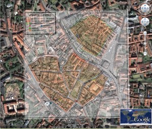
Vilnius Ghetto on Google earth
This link is to an overlay over the centre of Vilnius in Lithuania. Since my visit in 2008 I have had an interest in the Vilnius Ghetto. Recently I have been playing with the overlay function on Google earth, thus I have combined the two.
I stole the map from www.deathcamps.org which is a wonderfully rich site. I then placed the map as an overlay. The time consuming bit is getting the maps closely aligned, this takes patience, but thankfully little skill, simply drag, skew and twist the image until it looks right, using the zoom helps. We now have a ‘then & now‘ ability to see where the Vilnius ghetto was in relation to the current city, and see change and continuity between the 1940s and today. I kept the key to show the key buildings
Below is a still image for those who don’t have Google earth


A lazy youth, a lousy age.
Ihr Blog ist sehr gut, wie ich
best lightweight stroller